
The sea bed hasn't had much love from Undiscovered Worlds to date. I've basically just applied a bit of randomness from a fractal at the global level and left it at that - and completely ignored it at the regional level. But of course the real sea bed is far more complicated! We need to try to emulate the look of hydrographical maps if ours are to be at all convincing.

First, we need to sort out continental shelves. The sea bed doesn't just slope gradually down from the edge of the land - it remains relatively shallow for quite a way and then drops off fairly suddenly. This is where the continental tectonic plate ends and the oceanic tectonic plate begins.
A fairly basic approach to this isn't too hard to do. First, we go over the map and at every coastal point we draw a circle. The radius of the circles varies according to a fractal map. This means we get a gradual variation in size throughout the map:

That's a start. Now we also offset the circles by an amount that is also determined by a fractal map. That shifts the edges of the shelves in a slightly more interesting way:

Finally, we run the whole thing over a fine-grained Voronoi map to make the edges a little more interesting (and also to help fill in some of the gaps that appear from offsetting the edges in that previous step):

Note that this is done before we apply a fractal to the whole map in order to remove some land. That means that where land is removed in that stage, continental shelf is left behind. The map above doesn't have many areas like that, but you can see for example at the southern edge of that large continent in the middle, where there is a peninsula and an island. Those are the remains of a larger area of land that's been removed (compare the previous maps above, where this hadn't happened yet). The continental shelf still extends across this whole area, which I think looks pretty good.
After this we add just a few little tweaks. We choose some random points within the shelves to be the centres of circles which we flatten to the level of the shelf, to disrupt the edges a little. Then, we re-use the flood-fill routine to ensure there are no areas of oceanic depth within the shelves.
All of that gives us the basic shapes of the continental shelves. Now we can add some variation to their depth, as well as to the depth of the oceans themselves. As always, this can be done with another fractal. In addition, yet another fractal is used to vary the extent of the smoothing of the sea floor, making some transitions between continental shelf and ocean more abrupt than others. That (together with some tweaks to the colours and shading, and the addition of climates on the land) gives us this:

And that seems to me to be looking pretty reasonable. Note here that the additional processes involved in making the continental shelves have meant that more (pseudo-)random numbers have been used, which means that the random numbers used when subtracting some areas of land later in the map generation process are different. In this case this has led to some more substantial areas of sea within the continental plates, rather like the Baltic Sea.
Now how does this look at the regional level? It took some time to get this working at all, because I simply hadn't bothered with generating sea beds before, except as part of the coastal generation process. I found the best way was to create a whole sea bed terrain, distinct from the normal terrain, and then paste it onto the regional map wherever there was sea. That way, tinkering with the sea bed generation wouldn't mess up the very carefully balanced (i.e. tinkered-with-to-death) coastal generation.
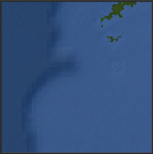
As you can see, that's unacceptably blocky. There isn't enough variation in the fractals in each tile to disrupt the tiles. I tried increasing the variation:

That is actually a pretty cool effect, but it's totally at odds with what I'm trying to do! It's caused by the edges of the tiles not matching, which is annoying as they're supposed to match.

The tiles are still very evident at the intersection of the continental shelf and the deeper ocean, though, no matter how much I crank up the noise. So I need to do something else to disguise this.


These are caused by water currents and sediment flowing from the shallower areas to the deeper ones, and they carve out these canyon-like features.
The easiest way to mimic these is to think of them like rivers, and that means we can re-use the basic methods for calculating rivers. At least, you'd think so. After typing the above I spent two days first trying to rewrite those methods to apply them to this situation, and then trying to write new routines from scratch, before giving up. In a perfect world I'd have these canyons at the edges of continental shelves, and perhaps at some point I'll find a way to add them in, but for now I'm going to stick with what I've got (which does match the edges of most continental shelves anyway).